
History
Polajewo Hauland, today Polajewice, was a relatively small Hauland likely created from the Polajewo estate. The community is situated today between Gebiczyn (Gembitz Hauland) to the west, Niewiemko (Glasshutte & Neuhutte) to the north, Wyszynki (Wischin-Hauland) to the east, and Radom to the south.
Minimal documentation is currently available concerning its founding. One source established the founding in approximately 1760.
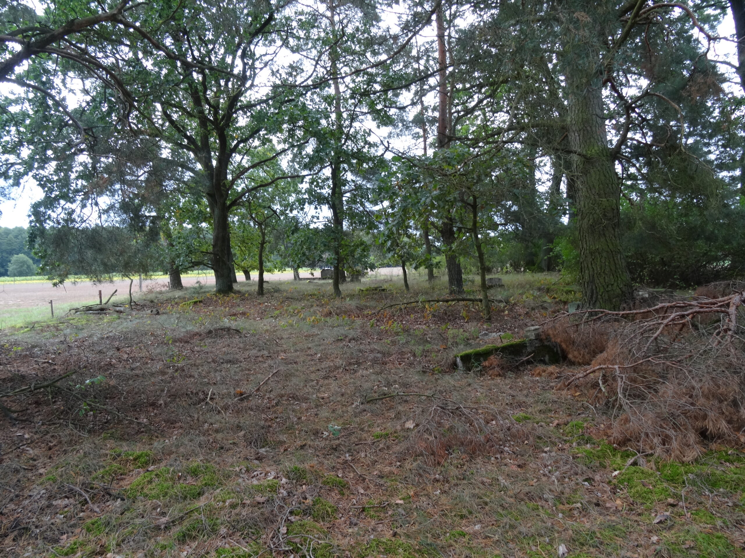
The farmers in Polajewo Hauland established both a school and cemetery along the Radom – Niewiemko road. The school operated until the end of World War 1 when the new Polish government closed it. The picture above is of the cemetery overlooking what was Farm 4. The cemetery, although overgrown, can still be visited today.
In 1772 the first partition of Poland took place. In that treaty Prussia received territory on the south side of the Netze River but not Polajewo Hauland which remained in the shrunken country of Poland. In 1793 Poland was again partitioned. After that partition Polajewo Hauland was in the Prussian administrative area now called South Prussia.
1793-1794 Land Records of South Prussia
In 1793 the Prussian government completed a census of the residents of their new territory. In that census Polajewo Hauland had seven heads of households. They are Michael Hecke (Henke), Michael Hencke (Henke), Christoph Schmidt, Johann Wichner, Johann Krentz, Andreas Krueger, and Peter Kumcke. In subsequent searches of the land records the properties of five of the seven residents can be positively identified as the following Michael Henke number 7, Christoph Schmidt number 4, Andreas Krueger number 6 and Peter Kumcke number 5. The properties of the second Michael Henke can be inferred to be number 3. The property of Johann Wichner is either 1 or 2 with John Krentz occupying the other.
Land Reform
On December 15, 1847 the General Commission of Posen established the ownership of eight plots of land within Polajewo Hauland. For Polajewo Hauland this is the beginning of the land records held today in Oborniki, Poland.
The process to record the ownership took over four years concluding on February 29, 1852. During this period there were ownership changes that took place which are recorded in the records.
The Polajewo estate still owned common meadows, fields and forest used by the farmers following the establishment of the farms in 1852. Those were divided by the General Commission of Posen on July 22, 1854, and added to the individual farmer’s holdings.
With the establishment of the land records mortgages and wills were now recorded for each property. The inheritance records are an invaluable source of genealogical information.
The analysis of the land records for Polajewo Hauland is difficult. In this Hauland as properties were divided and sold property numbers (referred to in the records as a Folium) were often changed and new numbers were added. In Gembitz Hauland if a property was divided the original plat number was usually maintained adding an A and B to the plat number. This results in estimating the locations of the farms easier than it was in Polajewo Hauland.
However, two resources are available in conjunction with the land records to make the task of determining the locations of the properties in Polajewo Hauland easier. First the 1877 Prussia Map shows 18 houses in the community. Second, the “Angelegenheiten der evangelischen Kirchen-Gemeinde Gembitz Hauland 1875 – 1911” available at the Poznan Archive lists 19 heads of households in the community. One resident was a day laborer living with another family. Fortunately, this document lists the families not by name but their physical location in the community. From the land records it can be determined that Property 1 was in the southwest end of the community.
The Original 8 Properties
The Partitions